The Causeway Coast is one of the most photographed coastlines in Europe —
and one of the most misrepresented. The tourist version involves a car
park and fifteen minutes at the Giant’s Causeway before
the next stop on the itinerary.
The real version involves Ballintoy Harbour at 6am when the light is
extraordinary and nobody else is there.
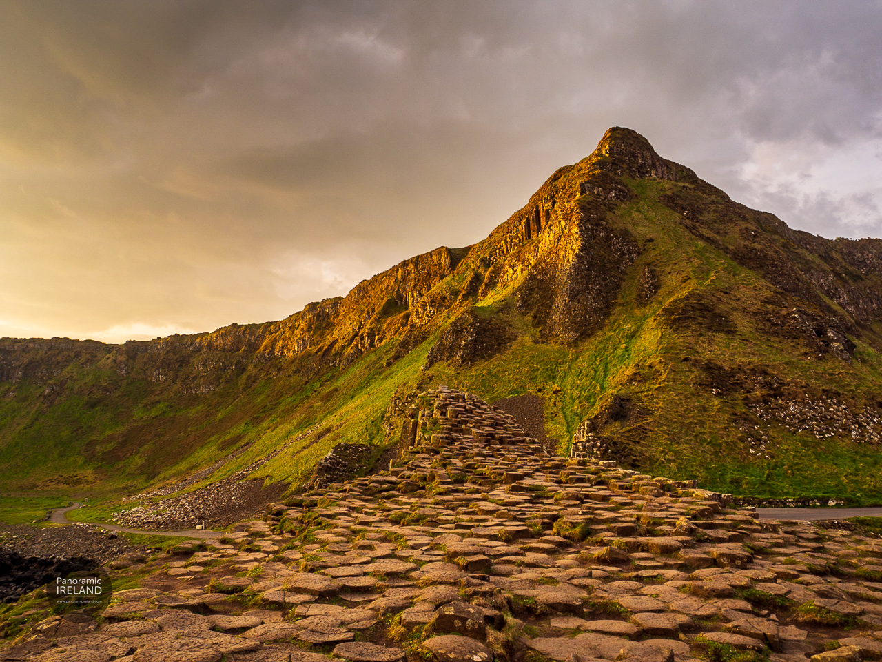
The basalt columns that formed here 60 million years ago look completely
different from the cliff path above than from the tourist boardwalk below.
The rope bridge at Carrick-a-Rede has been there in various forms for
350 years — the fishermen who built it were accessing salmon runs, not
creating a tourist attraction. Rathlin Island, visible from the coast
on a clear day, has the largest seabird colony in Ireland and
almost no visitors outside a short summer window.
The experiences curated on this page are built around one idea: the
Causeway Coast rewards the visitor who slows down, arrives early, and
goes slightly further than everyone else.
Getting there
Air: The closest international hub is Belfast — both George Best Belfast City
(closer to the city centre) and Belfast International (west of the city) put you
within roughly 60–75 minutes’ drive of the heart of the Causeway Coast, traffic
depending. Dublin Airport is a common alternative — count on 3+ hours by road
to reach the coast; fine if you are touring the island, less ideal for a short
Causeway-focused trip. City of Derry Airport is smaller but closer to the
north-west of the region if your journey suits it.
Ferry: Car and passenger ferries from Scotland (e.g. Cairnryan–Larne or
Cairnryan–Belfast) are a practical option if you are already in the UK and want
to avoid a second flight — you will still want wheels on the ground afterwards
(see below).
Train & bus: You can reach Ballymena, Coleraine, or Portrush by
public transport from Belfast with Translink, which is useful if you plan to
stay in one town and walk locally. There is no coastal railway that strings
together Ballintoy, the Causeway, Dunluce, and the eastern headlands — those links
are road or organised tours.
Getting around
A hire car is the option we recommend for this stretch of coast — not because
public transport does not exist, but because the best of the Causeway is spread
out and often off the main corridor. Having your own
vehicle means you can reach Ballintoy before coaches, move from the stones to
Dunluce in minutes, take the Rathlin ferry without watching the clock, and head for shelter when the rain comes in.
Driving is on the left; signage and speeds are (mph). Country roads can be narrow;
leave passing room on bends and of course expect farm traffic.
Cycling suits fit riders comfortable with wind, hills, and occasional heavy
traffic on the A2 — quieter parallel lanes exist in places but are not continuous.
Coach and day tours from Belfast or Derry work if you prefer not to drive; they
cover the headline stops reliably. You trade flexibility for convenience — which is a fair swap for some visitors, but not how we would plan a slow-travel week.
On foot: Walkers link sections of the Waymarked Ways and coastal paths, but
that is a different trip (baggage transfer, linear planning). For most visitors,
train or bus to a base + car hire is the realistic split.
Photographer’s Notes
The Causeway Coast is a morning coast. The basalt columns face northeast
and catch the best light in the two hours after sunrise. Ballintoy
Harbour faces west — go there in the late afternoon for the light
on the harbour walls.
Rathlin Island in May and June: the puffins are at the RSPB West Light
Viewpoint on the west cliff. The ferry crosses from Ballycastle in around 25
minutes. The puffins nest right at the clifftop edge and you can watch
them and fulmars from the viewing platform.